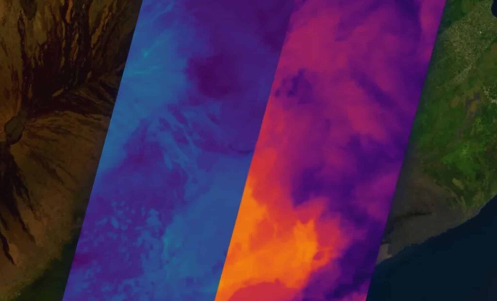
A new satellite initiative by Muon Space promises to change the way we detect and monitor wildfires around the world. This effort, spearheaded by the launch of the FireSat Protoflight satellite, is set to form part of a larger constellation that will scan the Earth every 20 minutes. This ambitious project aims to help detect wildfires early and provide invaluable data to first responders, policymakers, and the affected communities. For more details on this innovative satellite technology, Muon Space’s own press release sheds light on its progress and goals for the future of wildfire monitoring.
A Game-Changer in Wildfire Detection
The FireSat satellite is equipped with cutting-edge infrared (IR) technology that can scan landscapes for heat signatures indicative of wildfires. Positioned in low-Earth orbit, the satellite uses a multi-band infrared instrument to detect heat emissions across various infrared wavelengths, from visible to long-wave infrared. This enables FireSat to identify fires, even at lower temperatures, offering a higher degree of accuracy and sensitivity than many current systems.
The significance of this technology lies in its ability to provide a rapid response to emerging wildfires. The Earth will be scanned every 20 minutes, allowing for near-real-time data to be fed to stakeholders. “These first light images confirm that our IR sensors are operating as designed and collecting high-quality data,” said Dan McCleese, Chief Scientist of Muon Space in a statement. “Infrared imaging with this quality is one of the most technically demanding domains in remote sensing, and we’re proud to be among the few commercial players advancing this capability in orbit.”
A new satellite system will scan the Earth every 20 minutes, providing real-time wildfire detection to help save lives and protect communities.


The FireSat Protoflight: Early Success
The FireSat Protoflight satellite, launched on March 14, 2025, aboard SpaceX’s Transporter 13 mission, marked a pivotal milestone for the FireSat constellation. The satellite’s first images, showing detailed heat signatures from areas as diverse as urban Sydney, Australia, and remote volcanic landscapes in Hawaii, demonstrated the satellite’s capability to capture high-resolution data in real-world conditions. With a scanning area width of 932 miles (1,500 km), FireSat can detect small fires as small as 15 feet (5 meters), offering unprecedented precision for wildfire detection.
The successful deployment of the FireSat Protoflight underscores the potential of the entire constellation. It represents not just a technological achievement but a significant leap forward in providing actionable data for preventing or mitigating the devastating impacts of wildfires.
Advancing a Global Network: The Vision for 2030
Muon Space’s plan to build a constellation of more than 50 satellites will be fully operational by 2030, with each satellite capable of scanning the Earth’s surface every 20 minutes. The goal is to offer frequent scans of wildfire-prone areas, ensuring that any new fire outbreak is detected as soon as possible. The FireSat satellites will be positioned in low-Earth orbit, where they will use high-tech sensors to provide valuable information to first responders and government agencies. This system is not only a breakthrough in wildfire detection but also a solution to an urgent global need for more reliable monitoring of fire activity in real time.
According to Jonny Dyer, CEO of Muon Space, “The FireSat first light images demonstrate Muon’s approach to building mission-optimized satellites including purpose-built instruments.” This forward-thinking approach could be a critical factor in addressing the wildfire crisis, particularly in regions where fire management infrastructure is limited or overwhelmed.

