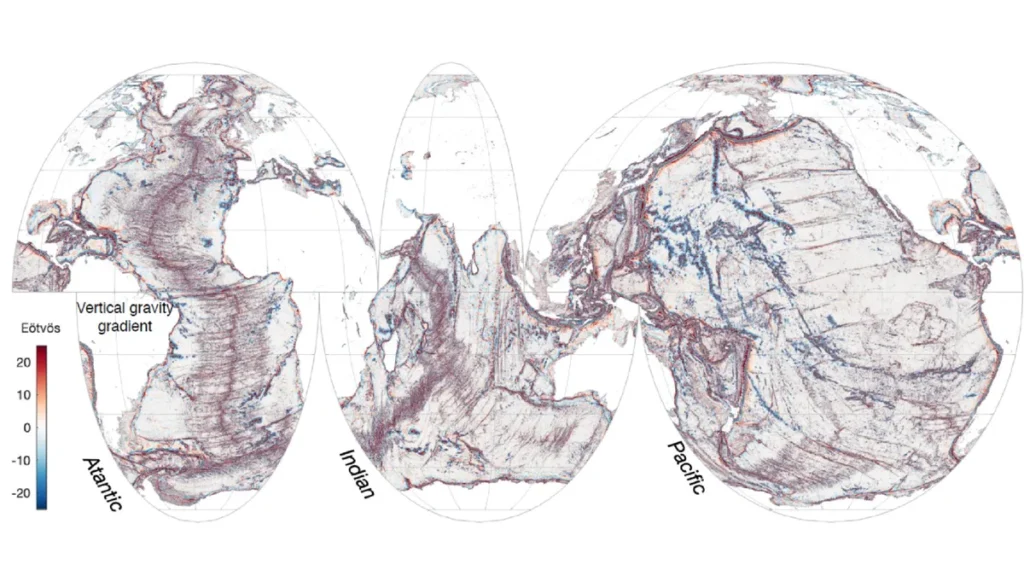
Published this month in the journal Science the study reveals how SWOT can ‘resolve subtle nuances of ocean circulation’ by measuring the topography of the ocean surface, which is ever-changing. Using this data, scientists are able to discern what gravity’s pull is like across any given swathe of ocean space.
By assessing this data, researchers can then develop deeper understanding of ocean phenomena such as internal waves at a level of precision likened in the study to the way a medical imaging device can view internal organs of the body.
“Finding these features will really push scientific developments forward, including tectonic theories,” said Yu in conversation with Live Science, adding that these findings could provide new information about ocean currents, nutrient transport in seawater, and the geologic history of Earth’s oceans.
To spot underwater features, SWOT measures the height of the ocean surface. The gravitational pull of underwater structures like hills and volcanoes causes water to pile atop those structures in “spread-out lumps”. Changes in the sea surface height therefore point to what lies deep beneath the surface.
The team behind the research trained most of their attention on three types of underwater features: abyssal hills, small seamounts, and continental margins – uncovering, as they did, uncharted seamounts and previously hidden tectonic structures.
Using SWOT data, Yu and the team were able to create a picture of individual hills as well as places on the sea floor where the direction of ridges changes, suggesting that at some point the tectonic plate that formed them changed the direction of its movement.
A lot of focus was placed on the study of underwater volcanoes, hotspots in the ocean for impacting upon ocean currents and biodiversity. In recent history, maps have been produced of some of the larger seamounts, however data from this study provided a clearer image of the thousands of smaller seamounts measuring at less than 1,000 metres tall.
The ultimate resolution of marine gravity from SWOT will provide sharpness to the level of around eight kilometres which is some way off the 200 metre scale resolution that can be obtained from ship-mounted instruments. It will, however, cover the three-quarters of the seafloor not yet mapped using ship data.
“We haven’t reached the plateau yet,” said Yu. “With more data accumulated, we will be able to study changes in the marine gravity field, such as from undersea volcano eruptions.”

